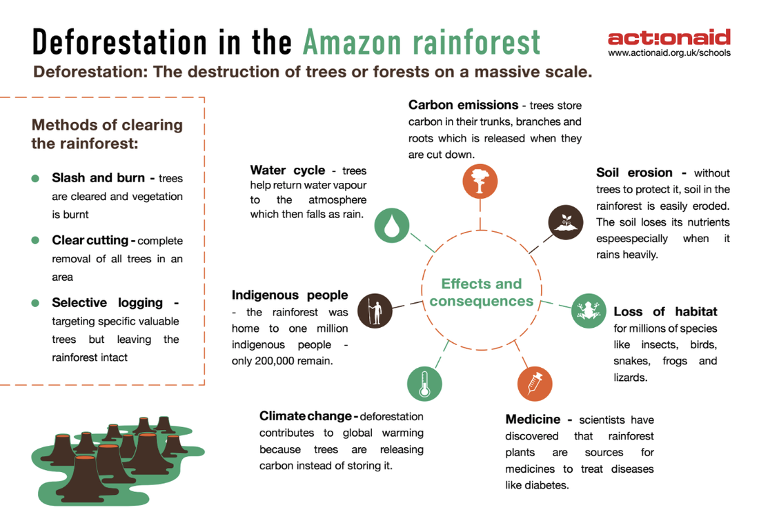
Photo 1 - The Amazon rainforest
This is an aerial view of the Amazon river surrounded by rainforest. The Amazon river is the widest and second longest river in the world. In places it is wider than six miles (over 15,000 buses)! The Amazon river is home to fish, dolphins, otters, turtles and snakes, as well as caimans which are carnivorous predators and close relatives of crocodiles.
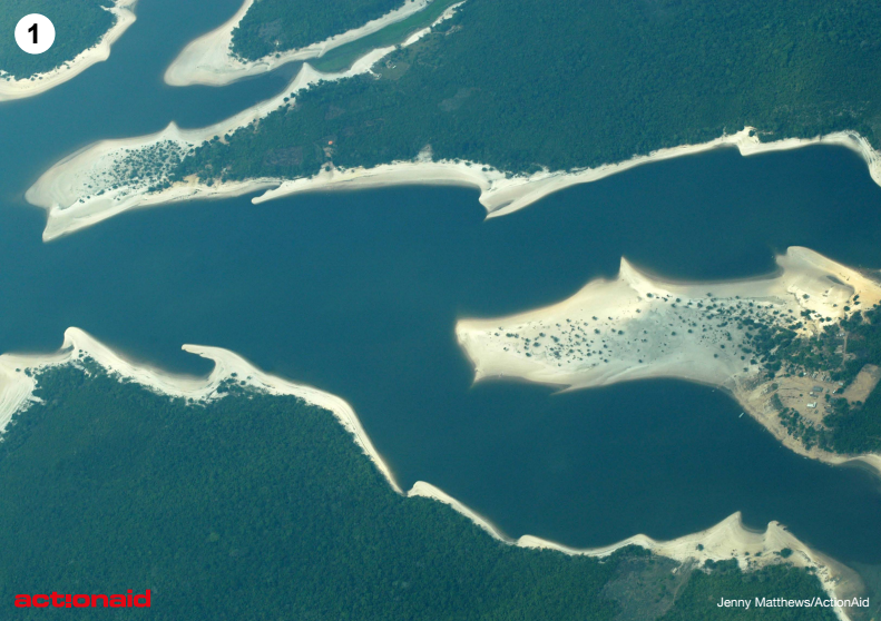
Photo 2 - Trees in the rainforest
Trees grow upwards very quickly in the hot, wet climate to form a green canopy. There are few branches in the middle layers. On the ground are shrubs and thick undergrowth which are filled with creepers - tall thin plants that wind upwards around the trees to reach the sunlight.
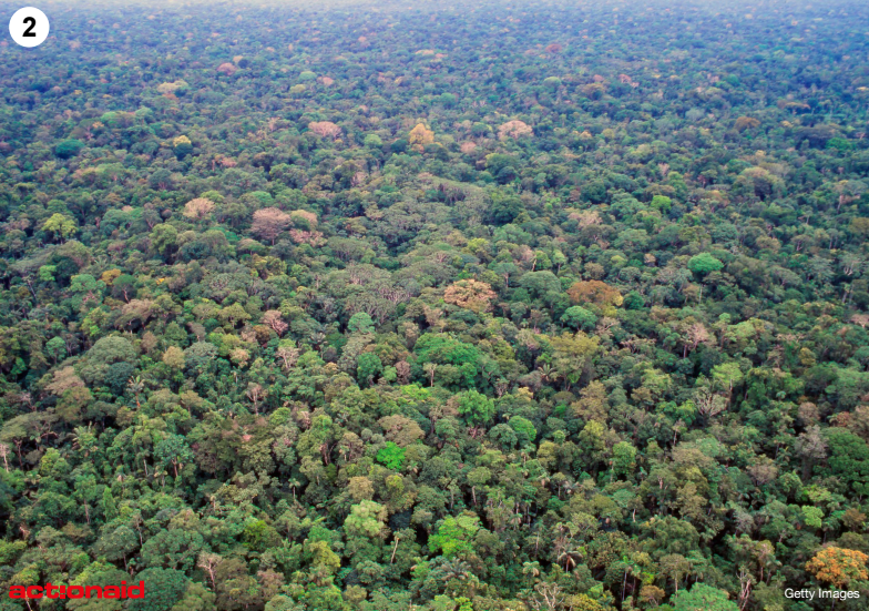
Photo 3 - Levels of the rainforest
In this photo you can see the different levels of the rainforest. At the bottom is the river and its banks and plants. In the middle you can see the bushes and shrubs of the shrub layer. There is then a gap where the leaves are thinner before the under-canopy and the canopy with the tallest trees.
|
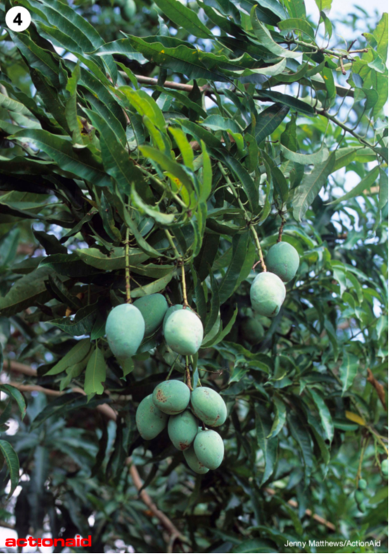
Photo 4 - Fruits and nutsThis a mango tree growing in the rainforest. Trees in the rainforest produce many different types of fruits and nuts including mangoes, passion fruit, bananas, cashew and brazil nuts, sweet potatoes and very hot chillis! The acai berry looks like a red grape and is very popular to eat with the people who live in the rainforest.
|
Photo 5 - Deforestation
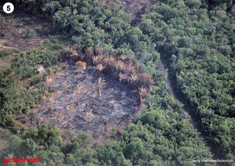
In this picture you can see an area of the forest which has been cut down and cleared. This is also known as ‘deforestation’. Deforestation means the clearing of large areas of forest lands which are never re-planted. Trees are cut down for many reasons including:
- To be used, sold or exported as timber, wood or fuel (charcoal). This is called logging.
- To be used for farming purposes, like cattle ranching or growing crops such as soya.
- To make room for human settlement and urbanisation – for example to build houses or roads.
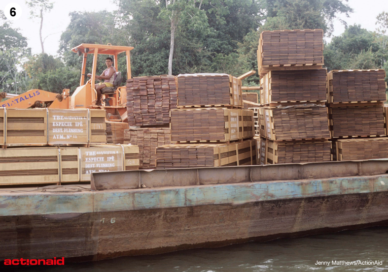
Photo 6 - Demand for timber
|
Today, logging is allowed with permission in the Amazon rainforest. It makes up a small percentage of deforestation here.
Organisations like Greenpeace are campaigning for a complete end to deforestation in the Amazon. They made a short film showing that trees are still cut down illegally in the rainforest (see video to the right) With the help of Google Earth, scientists at the University of Maryland have made an interactive online map. This shows how much of the world’s forest has been lost and gained from the year 2000 to 2012. You can find it here: www.bbc.co.uk/news/science-environment-24934790 Brazil showed the best improvement of any country, cutting its deforestation rate by half in the period 2000-2012. |
|
Photo 7 - Slash and burn
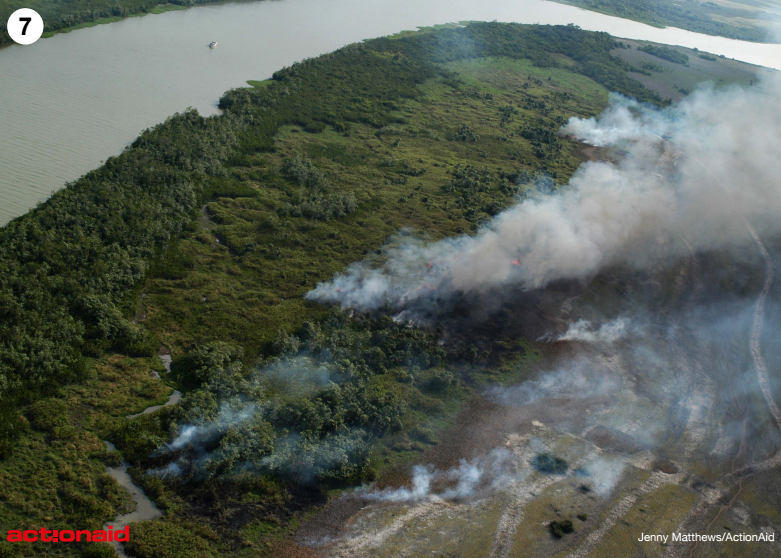
In this photo you can see a process known as ‘slash and burn’. Trees are cut down and the land is burnt in order to clear it to grow crops such as soya. However, the biggest cause of deforestation in the Amazon is cattle ranching. If you went to the Amazon today, you would find millions of cattle grazing on the land. Brazil is now the world’s largest exporter of beef. This is the meat which comes from cattle and is used to create foods such as steaks or burgers.
|
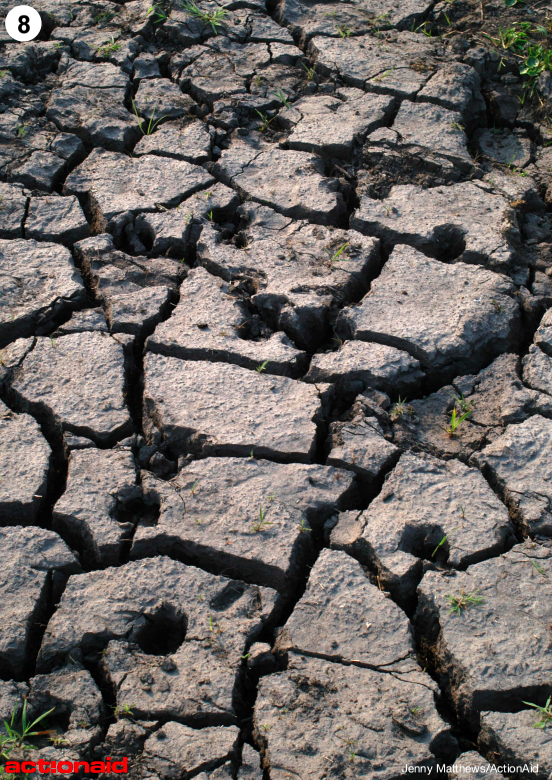
Photo 8 - Forest to desertIn both 2005 and 2010, the Amazon was struck by extreme drought. A drought is a long period of time when no rain falls. In a drought plants do not grow properly, rivers dry up and trees and wildlife die. In areas where trees have been cut down, hot winds blow away the topsoil.
During the Amazon rainforest drought many trees died. Scientists say that the forests stopped absorbing CO2 from the atmosphere, and as the dead trees rotted they released CO2 to the atmosphere. |
Photo 9 - Jacara
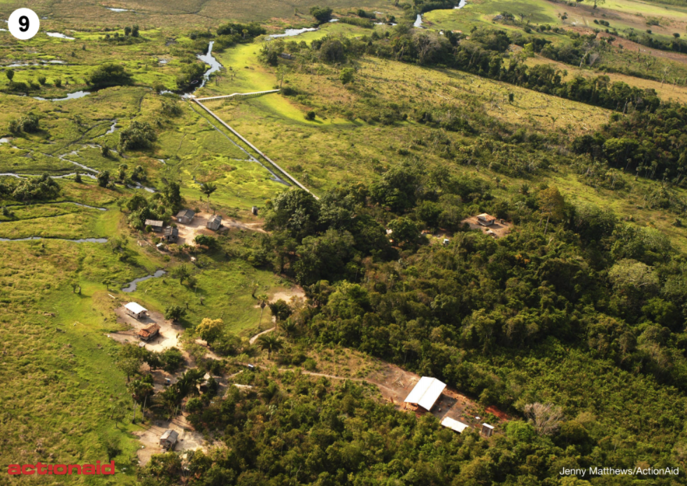
This picture is an aerial view of Jacara where a smaller river flows out of the Amazon River. This picture shows the river, the houses where people live, trees and grassland. It is hot and humid most of the year and rains almost every day.
People use boats to travel to different places. They also use walkways which you can see in the middle of the picture. They are made of wood and raised above the ground to keep people safe from snakes!
People use boats to travel to different places. They also use walkways which you can see in the middle of the picture. They are made of wood and raised above the ground to keep people safe from snakes!
Photo 10 - Houses among the trees
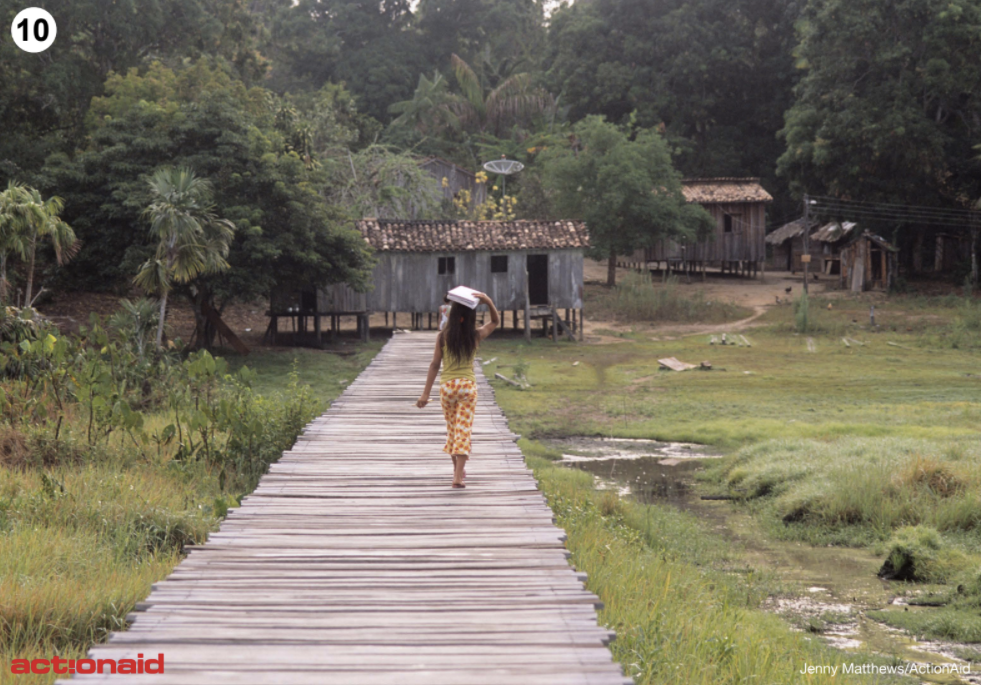
The Gomez family live in the rainforest. Like most families in the area, they grow their own food or fish for it in the river. They have a small farm where they plant vegetables such as cassava, corn, beans and potatoes. Fruit like bananas, oranges and mangoes grows on the farm and around the house.
There are dangers, though. Loggers, people who cut down trees to sell, offered the community money to let them clear the rainforest where they live.
There are dangers, though. Loggers, people who cut down trees to sell, offered the community money to let them clear the rainforest where they live.
|
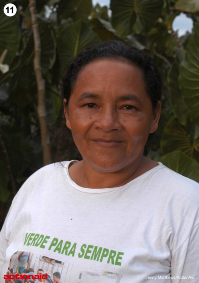
Photo 11 - Forever Green Mum, Luiza, and other community members worked to protect their land by protesting to the government and campaigning against the loggers.
In 2004 the Brazilian government set up an ‘extractive reserve’. This means local families have collective rights to the land and natural resources. Luiza’s T-shirt has the words, ‘Verde Para Sempre’ on it in Portuguese. This means, ‘Forever Green’ and is the name of the area of the rainforest where she lives. |
|
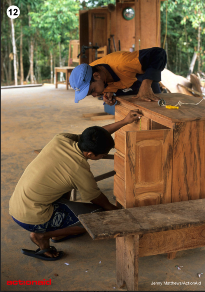
Photo 12 - Extractive reserve The people who live in Forever Green can use the land in the reserve as long as they look after the forest.
Local families earn a living by collecting products such as nuts, fruit and rubber, and making furniture from fallen trees. This way they can support themselves through traditional activities whilst looking after the environment. In this photo, community members are making a cabinet out of wood from a fallen tree. The community works with nature, rather than against it, and believe the trees, rivers, birds and wildlife are all connected. Today, the reserve is still at risk of destruction and ActionAid and Greenpeace continue to support the local community. |